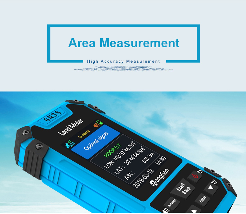
GNSS GPS High Accuracy Agriculture Land Area Measuring Tools
Handheld GPS Survey Equipment
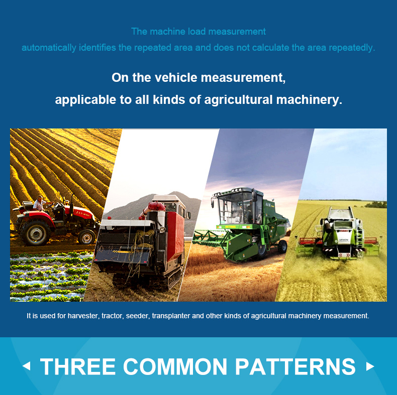
Round-trip machine load:
1. At the Round-trip machine load in parameter setting,press the
[▲/▼]button to set the width.
2. After setting is completed,press the to return main interface.
3. Press the [▲/▼]button switch function to Round-trip machine
load"in the main interface.
4. Press [Start] button at the starting point to start the
measurement at the beginning of the work.Press the [Stop] button to
pause measurement
and view data after agricultural machinery work is completed;If the
measurement is not completed,press the [Start] button again to
continue the
measurement. If the measurement is completed,press power button to
save the data.
Circle machine load measurement:
1. Circle machine load measurement function is used to measure area
around the land, set the position of the land meter in the vehicle
and the
nearest distance of the ground boundary, and then measure the
boundary around the region.Then measuring around the boundary of
the land.
2. At the Circle machine load in parameter setting, press the
[▲/▼]button to set the edge distance.
3. After setting is completed, press the to return main interface.
4. Press the [▲/▼]button switch function to Circle machine load"in
the main interface.
5. In the main interface, press the[ Start] button to measure at
starting point.
6. After a circle around the land under test, press the[ Stop ]
button to end measurement and view data press power button to save
data.
Length and width area measurement:
① In the main interface,press the ▲▼to switching function to
“Length and width”.
② At the starting point A press the【Start】button to measure,and
press the【Enter】button to save the point A,go to the inflection
point B,and press the【Enter】button to save the point B,go to the
inflection point C,press the【Enter】button to save point C.
③ Press the【Stop】button to end measurement and view data,and press
power button to save the data.
Note: if you want to end the measurement before 3 points are
collected,Press the【Stop】button to pause the measurement.
Fixed width area measurement:
① At the Fixed width in parameter setting, press the ▲▼button to
set the width.
② After setting is completed,press the power button to return main
interface.
③ Press the▲▼button switch function to “Fixed width”in the main
interface;press the【Start】button to measure in starting
point;Press【Stop】button to pause measurement when measuring to the
bottom line and view data;If the measurement is not completed,
press the【Start】button again to continue the measurement. If the
measurement is completed,press power button to save the data.
Fixed point measurement:
① In the main interface,press the ▲▼to switching function to“Fixed
point”.
② At the land starting point,press the【Start】button to start
measuring,and press the 【Enter】 button to confirm the information
of the starting point.
③ Walk along the edge of the land,press the 【Enter】button at each
inflection point to collect the information of each inflection
point;
④ After collecting the information of the last inflection point
(not coinciding with the starting point),press【Stop】button to pause
the measurement and view the data.
⑤ If the measurement is not completed,press the【Start】button again
to continue the measurement. If the measurement is completed,press
power button to save the data.
| Product Name | Handheld GPS Survey Equipment |
| Work Temp. | -20℃-+60℃ |
| Measure shape | Regular or irregular shape |
| Dimension | 4.6*2.4*0.8 inch |
| Funtion | Readable under bright environment |
| Features | High accuracy, Reliable |
| operate | Easy |
| battery power | Lithium+AAA battery |
Functions | S3 |
| Positioning accuracy | 2.5m |
| Initial barometric calibration | × |
| Normal area measurement | √ |
| Mountain area measurement | × |
| Intell. Slope measurement | × |
| Fixed point measurement | √ |
| Fixed width area measurement | √ |
| Normal distance measurement | √ |
| Manual distance measurement | √ |
| Altitude display | √ |
| Altitude measurement | √ |
| Track display | √ |
| Mu setting | √ |
| Unit setting | √ |
| Time display | √ |
| Data statistics | √ |
| Historical record | √ |
| Lighting /Currency detection | √ |
| Dry battery | √ |
| lithium battery | √ |
| Data storage | 200 |
| Voice broadcast | √ |
| Data export | × |