GNSS GPS Survey Equipment High Accuracy GPS GNSS HandHeld Land
Measurement Navigation GPS Land Meter
Manual directory of GNSS GPS survey equipment:
Technical Parameters
Display and Buttons Introduction
Battery Installation, Power On and Off
The Function of Power on
The Function of Power Off
Slope Setting and Unit Setting
Display Format And Gaussian Parameter
Elevation Calibration and HDOP Setting
Electronic Compass Calibration
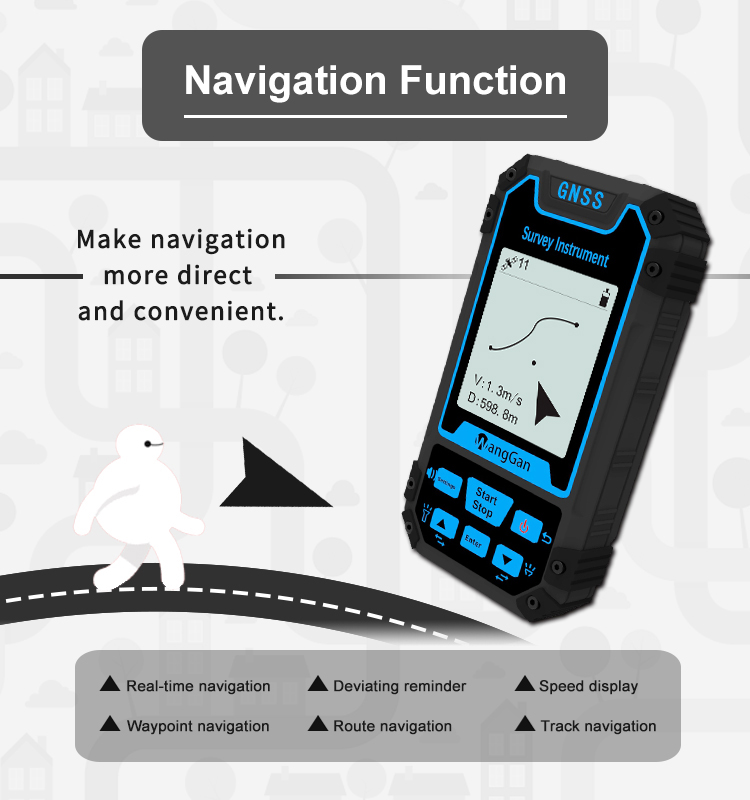
The Function of Angle Measurement
The Function of Restore Factory Setting
About This Mac
The Viewing And Management Function of Data Record
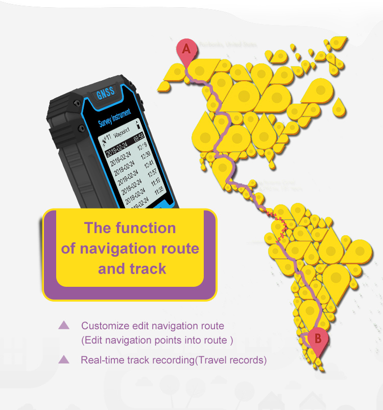
The Acquisition Function of Way-point
The Entry Function of Waypoint
The Navigation And Viewing Function of Waypoint
The New create Function of Route (Combining Existing Points into
Routes)
The Viewing Function of Route
The Navigation Function of Route (Navigate To the Route)
The New create and Management Function of Lofting
The Navigation Function of Lofting (Point-by-Point Navigation of
Lofting Points)
Equal Distance Lofting And Equal Division Lofting Creation
The Lofting Creation Function of User-Defined Distance
The Usage and Opening Function of Track
The Navigation and Viewing function of Tack
Area Measurement Function
Distance Measurement Function
Technical Parameter of GNSS GPS survey equipment:
| Receiver Chip | High Sensitivity GNSS Receiver Chip |
| Receiver Antenna | Taimeng Passive Large - Size flat plate antenna |
| Positional Time | Hot Start Time: one Second; Cold Start Time: 30 Seconds |
| Positional Accuracy | Within 2 Meters (HDOP Value Less Than 1.0) |
| area Accuracy | Measurement error is not more than 0.03 Mu (1-3 Mu), 2% (More Than
3 Mu) |
| Distance Accuracy | Within one Meter (When HDOP value is less than 1.0, measure the
length of 100 meters) |
| Functional Characteristics | Coordinate Measurement, Route Edit, Track Record, Navigation
Function, Altitude Measurement, Area Measurement, Distance Measurement, Lofting Function |
| Data Statistics | Area Statistics, Distance Statistics |
| Area Record | 99 pieces | Waypoint Record | 2000pieces |
| Distance Record | 99 pieces | Track Record | 100pieces |
| Route Record | Maximum Number Of Editions 200, Single Route Up To 400 Points |
| Track Display | The trajectory will be displayed in real time during the
measurement process, and the past measurement figures can also be
viewed in the statistical records. |
| Barometric Altimetry | About one meter (Barometer measurement, absolute altitude needs to
be calibrated) About 10 Meters (GPS Measurement, HDOP value below
1.0) |
| HDOP Settings | User-Defined HDOP Setting |
| Display Screen | 2.4 Inch, outdoor high-definition black-and-white screen |
| Working Temperature | -20℃~65℃ |
| Storage Temperature | -40℃~75℃ |
| Device Size | 117mm*61mm*20mm |
| Device Weight | 120 G (Battery Free) |
| Data Interface | USB Interface, Which Can Be Charged Through This Interface |
| Standard
Configuration | Host*1, Lithium Battery*1, Charger*1, Data Cable*1, Lanyard*1,
Manual*1, Warranty Card*1, Package*1 |