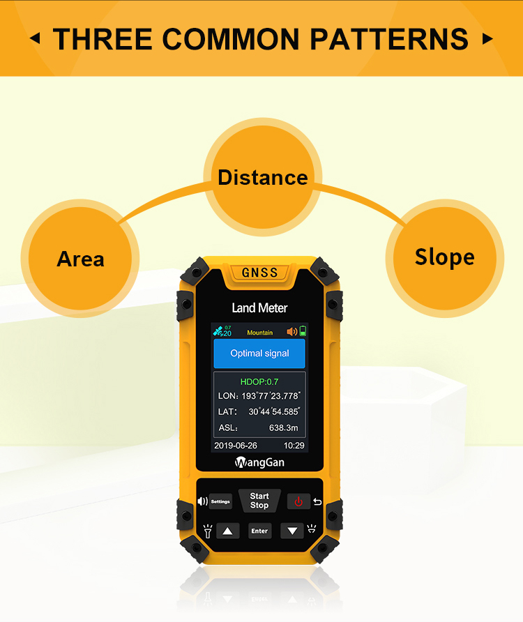
GPS Survey Equipment Mountain And Slope Measurement High Accuracy
Land GPS Measuring Tool
Altitude choose of GPS measuring tool:
① On the home page of boot,press the 【Settings】button to enter the
settings interface;
② Press the▲▼button move to“System setting”;Press the【Enter】button
to enter;
③ Press the【Enter】button to the altitude;
④ Press ▲▼ button to choose GPS or barometer;
⑤ After finishing setting,press thebutton to exit.
Note: if you choose the barometer, you need to calibrate the
height. The measurement is more accurate after calibration.
• Altitude calibration(just for S4)
① On the home page of boot,press the 【Settings】button to enter the
settings interface;
② Press the▲▼button move to“Altitude calibration”;Press
the【Enter】button to enter;
③ Press ▲▼ button to adjust the value of number;
④ After finishing setting,press the button to exit.
• Data record
• Statistics record
① On the home page of boot,press the 【Settings】button to enter the
settings interface;②Press the▲▼button move to“Data record”;Press
the【Enter】button to enter;
③ Press ▲▼ button to “Statistics record”,then press
the【Enter】button to enter;
④ Press ▲▼ to choose area or distance in the data record interface;
⑤ Press 【Enter】button can delete the data.
• Measuring record
① On the home page of boot,press the 【Settings】button to enter the
settings interface;
② Press the▲▼button move to“Data record”;Press the【Enter】button to
enter;
③ Press ▲▼ button to “Measuring record”,then press the【Enter】button
to enter;
④ Press ▲▼ to select a record in the measuring record interface;
⑤ Press the【Enter】button to view detailed data information;
⑥ Press the 【Settings】button can view the graphic display.(Press
【Enter】button can delete the data.)
• Factory reset
① On the home page of boot,press the【Settings】button to enter the
settings interface;
② Press the▲▼button move to“Factory reset”;Press【Enter】to factory
reset interface;
③ Press the▲▼button to select "Yes" ;
④ Press【Enter】to restore the factory settings.
Note: restore the factory settings will clear all measuring data
and parameter setting.