Handheld GPS Measuring Tool Land Area Digital Measurement Meter
Device Measuring Forest Land
Length and width area measurement of handheld GPS measuring tool:
①In the main interface,press the ▲▼to switching function to “Length
and width”.
②At the starting point A press the【Start】button to measure,and
press the【Enter】button to save the point A,go to the inflection
point B, and press the【Enter】button to save the point B,go to the
inflection point C,press the【Enter】button to save point C.
③Press the【Stop】button to end measurement and view data,and press
"power" to save the data.
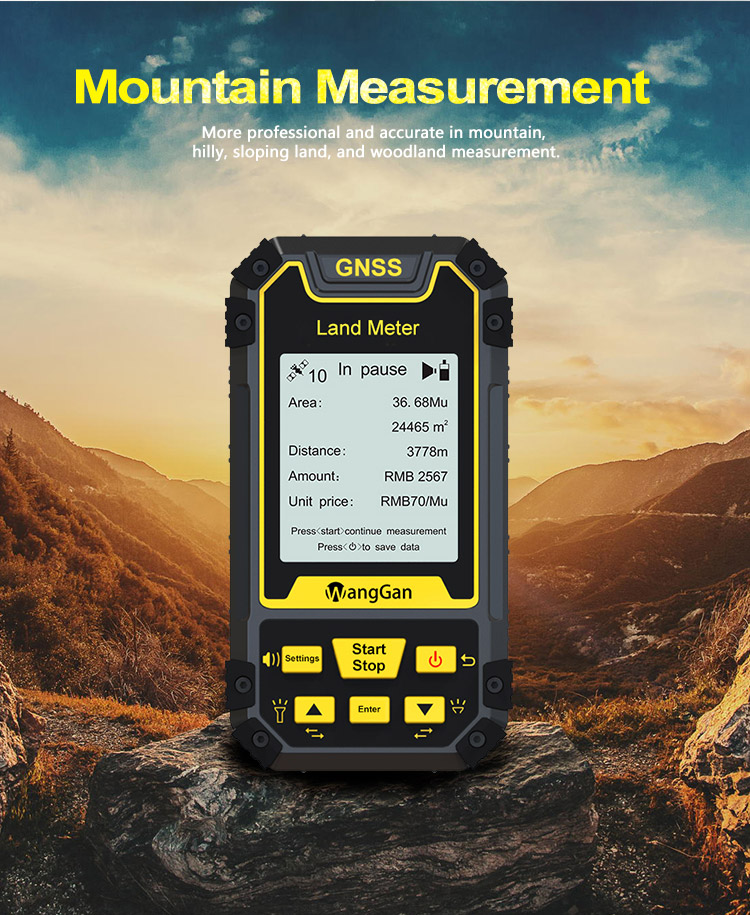
Mountain area measurement
①In the main interface,press the ▲▼to switching function to
“Mountain”.
②Press the 【Start】button to measure at the top of the mountain,and
press the 【Enter】 button to confirm the information.
③Press the【Enter】button and proceed from the foot of the
mountain,walk around the foot of the mountain,and back to the
starting point, press the【Enter】button,then press the【Stop】button
to end measure and view data;
④press "power" botton to save the data.
In the measurement interface,three letters A,B and C will be
displayed next to "Mountain" above the screen.
A represents the location information of the mountain top
collected.
B represents the starting point at the foot of the mountain.
C represents to go around the foot of the mountain from the
starting point and then back to the starting point.
Fixed point area measurement:
①In the main interface,press the ▲▼to switching function to“Fixed
point”.
②At the land starting point,press the【Start】button to start
measuring,and press the 【Enter】 button to confirm the information
of the starting point.
③Walk along the edge of the land,press the 【Enter】button at each
inflection point to collect the information of each inflection
point;
④After collecting the information of the last inflection point (not
coinciding with the starting point),press【Stop】button to pause the
measurement and view the data.
⑤If the measurement is not completed,press the【Start】button again
to continue the measurement. If the measurement is completed,press
"power" to save the data.
Note:
When using the fixed point function,two words of “fixed point ”will
be displayed at the measurement interface.
When using the area measurement function,the measurement area icon
will be displayed on the left side of the measurement interface.
When using the fixed width function,the words on the right side of
the measurement interface represent the number of points collected.
Operation instructions of Distance measurement:
Normal distance measurement function
①In the main interface,press the【Start】button for 3 sec to
measurement at the starting point.
②Walk along the measuring line to the end point and press the
【Stop】button to stop the measurement and view the measurement data;
③ If the measurement is not completed,press the【Start】button again
to continue the measurement. If the measurement is completed,press
"power" to save the data.
Voice,Currency detection lamp and flashlight
Opening and closing of voice
Long press the【Settings】button to open or close the voice at any
interface.
Voice opening state:
Voice closing state:
Opening and closing of currency detection lamp and flashlight
Flashlight and currency detection lamp need to be in the main
interface of the Land meter,
Long press the【▲】button to open or close the flashlight.
Long press the【▼】button to open or close the currency detection
lamp.