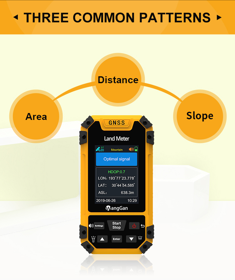
Handheld GPS Survey Equipment Mountain Slope Flat Land Measurement
High Accuracy Land Measuring Device
Function switch of GPS land meter:
① On the home page of boot,press the▲▼button to switch measurement
mode;
② On the home page of boot,press the【Enter】button to view the
current measurement mode and the parameter setting.
• Area measurement
• Preparation of measurement
① Turn on the land meter in an open field;
② After started up,it needs to search for signal;There are voice
prompts,text prompts,signal state and HDOP value on the screen;It
is recommended to start measuring when the HDOP value is below 1.0.
③ After finishing searching for signal,it can start measuring
according to function demands.
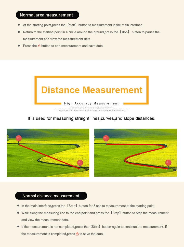
• Normal area measurement
① At the starting point,press the【start】button to measurement in
the main interface.
② Return to the starting point in a circle around the ground,press
the【stop】 button to pause the measurement and view the measurement
data.
③ Press the "Start" button to end measurement and save data.
• Mountain area measurement (just for S4)
① At the starting point,press the ▲▼to switch function to
“Mountain”mode in the home interface;
② Press the 【Start】button to measure at the top of the
mountain,then press the 【Enter】 button to confirm the information.
③ Press the【Enter】button and proceed from the foot of the
mountain,walk around the foot of the mountain,and back to the
starting point,press the【Enter】button,then press the【Stop】button to
end measure and view data;
④ press "Start" to save the data.
• Intelligent slope measurement
The way of measuring is similar to normal area measurement.(please
refer to normal area measurement method)